Satellites play a critical role in military intelligence, surveillance, and reconnaissance (ISR) operations by providing real-time and strategic data for decision-making, situational awareness, and mission planning. Here’s how satellites are used in military ISR:
1. Imagery Intelligence (IMINT)
Satellites equipped with advanced imaging sensors capture high-resolution images of the Earth’s surface, enabling military forces to monitor and assess activities in specific areas.
- Electro-Optical (EO) Imaging:
- Provides high-resolution visual images in the visible spectrum.
- Used for mapping terrain, identifying military installations, and assessing battle damage.
- Example: DigitalGlobe’s WorldView satellites.
- Infrared (IR) Imaging:
- Detects heat signatures, allowing the monitoring of troop movements, vehicle activity, or hidden installations at night or under cloud cover.
- Example: Lockheed Martin’s SBIRS (Space-Based Infrared System).
- Synthetic Aperture Radar (SAR):
- Provides detailed images by using radar signals, regardless of weather or lighting conditions.
- Capable of penetrating foliage, camouflage, and some structures.
- Example: Sentinel-1 and military-grade SAR satellites like India’s RISAT series.
2. Signal Intelligence (SIGINT)
Satellites intercept and analyze electronic signals, such as communication transmissions, radar emissions, and other electromagnetic signals.
- Communication Interception:
- Monitors enemy communications, such as radio, satellite phone, and other transmission channels.
- Used for decoding messages, identifying patterns, and tracking the location of communication devices.
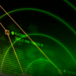
- Radar and Emitter Tracking:
- Detects and characterizes radar systems and other electronic emitters to identify military assets like air defense systems or naval vessels.
- Example: National Reconnaissance Office (NRO) SIGINT satellites.
3. Electronic Intelligence (ELINT)
Satellites monitor non-communication electromagnetic signals, such as radar or missile guidance systems.
- Radar Detection:
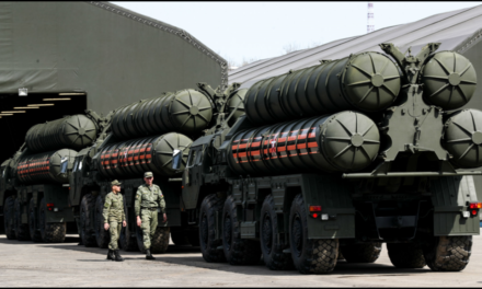
- Identifies and tracks radar installations, helping locate anti-aircraft systems or missile launch sites.
- Early Warning Systems:
- Detects missile launches and provides early warning to allied forces.
- Example: SBIRS and Russian Tundra satellites.
4. Communications Relay
Satellites facilitate secure and reliable communication for military forces operating in remote or hostile environments.
- Tactical Communication:
- Provides real-time communication links between deployed units, command centers, and allies.
- Example: MILSTAR and AEHF (Advanced Extremely High-Frequency) satellite systems.
- Data Transmission:
- Transmits imagery, SIGINT, and other data collected by satellites to ground stations or other platforms for analysis.
5. Navigation and Timing
Satellites provide precise positioning, navigation, and timing (PNT) services critical for military operations.
- GPS and GNSS:
- Enables accurate targeting, troop movement coordination, and navigation in unfamiliar or hostile terrain.
- Examples: GPS (USA), GLONASS (Russia), Galileo (EU), and BeiDou (China).
- Jam-Resistant Systems:
- Military-grade GNSS systems are designed to resist jamming and spoofing attempts by adversaries.
6. Maritime Surveillance
Satellites monitor naval activities, including the movement of ships, submarines, and other maritime assets.
- Automatic Identification System (AIS):
- Tracks ship movements using onboard transponders detected by satellites.
- Identifies unauthorized or suspicious vessels, aiding in anti-piracy and smuggling operations.
- SAR Imaging for Maritime Use:
- Detects vessels under cloud cover or in rough seas.
- Tracks naval deployments and sea-lane activities.
7. Missile Detection and Tracking
Satellites provide critical data on missile launches and trajectories for early warning and interception.
- Infrared Detection:
- Detects heat signatures from missile plumes during launch phases.
- Trajectory Prediction:
- Tracks missile flight paths, enabling defensive measures like interceptors.
- Example: SBIRS and NATO’s early warning systems.
8. Monitoring Adversary Activities
Satellites observe enemy military operations, bases, and strategic assets.
- Base Monitoring:
- Tracks construction, troop movements, and activity levels at military bases and airfields.
- Troop Movement Detection:
- Identifies large-scale deployments, such as tanks, convoys, or aircraft formations.
9. Space-Based Radar
Military satellites equipped with radar systems provide continuous surveillance.
- Wide-Area Monitoring:
- Tracks activity over large regions for early warning or crisis response.
- Change Detection:
- Identifies subtle changes in terrain or infrastructure, such as new construction or troop mobilization.
10. Counterspace Operations
Satellites are used to detect and counter threats from adversary space-based assets.
- Space Situational Awareness (SSA):
- Tracks other satellites, space debris, and potential threats in orbit.
- Jamming and Countermeasures:
- Monitors and responds to jamming or spoofing attempts against allied space assets.
Advantages of Using Satellites for ISR
- Global Coverage: Provides surveillance of remote and inaccessible regions.
- Persistent Monitoring: Offers continuous observation of areas of interest.
- High-Resolution Data: Delivers detailed imagery and signal intelligence.
- Rapid Response: Quickly detects and monitors emerging threats.
- Secure Communication: Ensures encrypted and jam-resistant data transmission.
Future Trends in ISR Satellites
- AI and Machine Learning:
- Enhances data analysis and anomaly detection, providing actionable intelligence faster.
- Small Satellite Constellations:
- Deploying swarms of small satellites for more frequent data collection and redundancy.
- Hyperspectral Imaging:
- Captures data across multiple wavelengths for detailed material and activity analysis.
- Quantum Communication:
- Provides secure data transmission resistant to hacking or interception.


