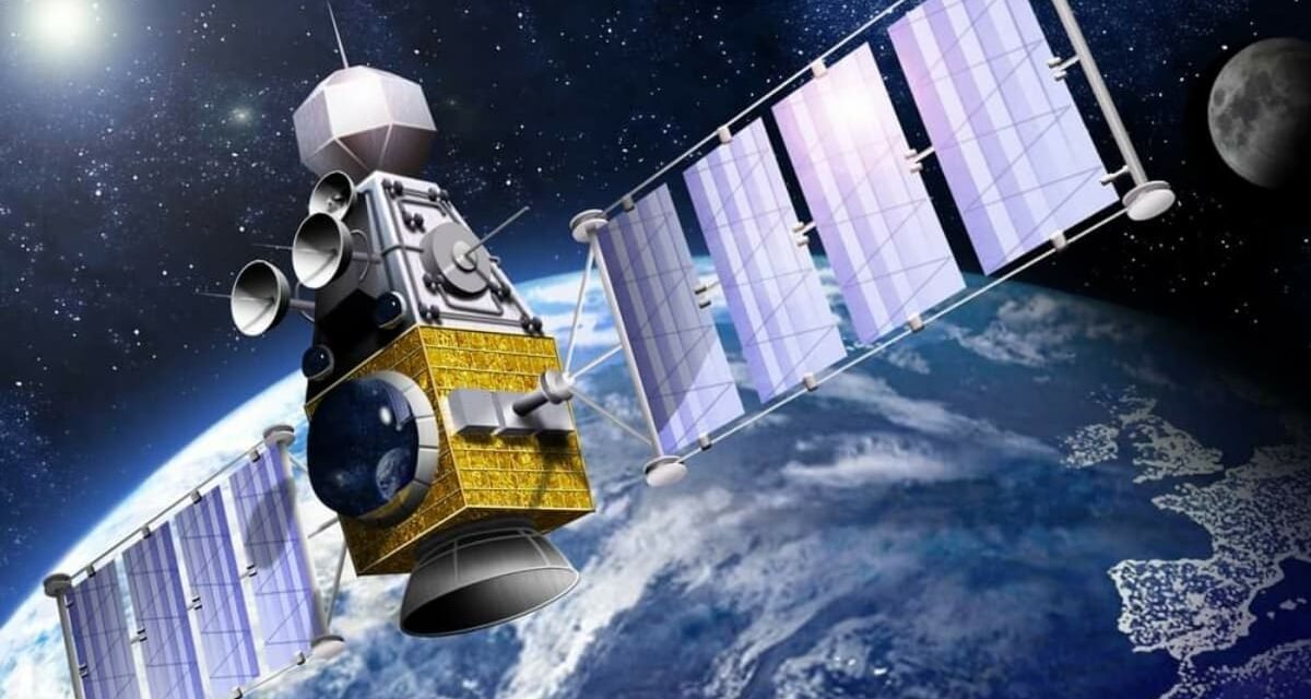
Military satellites play a crucial role in intelligence, surveillance, and reconnaissance (ISR) by providing real-time data, imagery, and communication support to military forces. These satellites operate across a wide range of missions, enabling strategic and tactical decision-making in modern warfare. Here’s how they contribute to ISR:
1. Intelligence Gathering
- High-Resolution Imagery:
- Satellites equipped with optical, infrared, and synthetic aperture radar (SAR) sensors capture detailed images of targets, enabling intelligence agencies to monitor enemy activity, infrastructure, and troop movements.
- Example: Detecting hidden missile sites, troop build-ups, or underground facilities.
- Electronic Intelligence (ELINT):
- Satellites intercept and analyze electronic signals emitted by enemy communication and radar systems to identify their capabilities and locations.
- Useful for mapping air defense networks or tracking communication patterns.
- Signals Intelligence (SIGINT):
- SIGINT satellites intercept radio, cellular, and satellite communications to gather intelligence on adversary plans and movements.
- Example: Monitoring encrypted transmissions for strategic insights.
2. Surveillance and Monitoring
- Persistent Coverage:
- Geostationary and polar-orbiting satellites provide continuous surveillance of specific regions, ensuring no gaps in coverage.
- Example: Monitoring high-conflict zones or international borders.
- Day/Night and All-Weather Surveillance:
- Infrared and radar-equipped satellites provide surveillance capabilities regardless of weather conditions or time of day.
- SAR systems are particularly valuable for tracking objects under cloud cover or camouflage.
- Maritime Surveillance:
- Satellites track naval vessels, detect illegal activities like smuggling or piracy, and monitor strategic maritime chokepoints.
3. Reconnaissance
- Battle Damage Assessment:
- Satellites assess the effectiveness of military strikes by capturing post-strike imagery of targets, helping planners refine future operations.
- Example: Verifying the destruction of enemy command centers or supply depots.
- Target Acquisition:
- Real-time satellite data provides precise coordinates for targeting by air, land, or naval forces.
- This enables precision-guided munitions to strike with accuracy.
- Tracking Mobile Targets:
- Reconnaissance satellites can follow the movement of mobile units, such as missile launchers, tanks, or convoys, in real time.
4. Space-Based Early Warning Systems
- Missile Launch Detection:
- Infrared-equipped satellites detect heat signatures from missile launches, providing early warning of incoming threats.
- Example: Systems like the Space-Based Infrared System (SBIRS) detect ballistic missile launches globally.
- Hypersonic Threat Tracking:
- Advanced satellites track the trajectory of hypersonic weapons, enabling timely defensive measures.
5. Communications and Data Relay
- Secure Communication:
- Satellites provide encrypted communication channels for command and control, ensuring secure and reliable information flow between dispersed forces.
- Example: Enabling coordination between ground forces, aircraft, and naval units in real time.
- Data Relay:
- Satellites relay data from drones, ground sensors, and other assets to command centers, integrating various ISR sources for comprehensive situational awareness.
6. Integration with Other Systems
- Unmanned Systems Support:
- Satellites guide unmanned aerial vehicles (UAVs) and autonomous systems, ensuring they stay on course and relay real-time data back to operators.
- Example: Supporting drones for border surveillance or battlefield reconnaissance.
- Multi-Domain Operations:
- Satellites link air, land, sea, and space-based assets, enabling seamless coordination and integration of ISR efforts.
7. Geospatial Intelligence (GEOINT)
- Terrain Analysis:
- Satellites generate high-resolution maps and 3D terrain models to aid mission planning and navigation.
- Example: Identifying suitable locations for troop deployment or understanding terrain obstacles.
- Environmental Monitoring:
- Monitoring weather conditions and environmental changes that could impact military operations.
8. Counter-Insurgency and Asymmetric Warfare
- Tracking Non-State Actors:
- Satellites provide intelligence on terrorist groups, insurgents, and other non-state actors operating in remote or inaccessible regions.
- Example: Monitoring training camps or supply routes.
- Disaster Response and Humanitarian Aid:
- ISR satellites assist in disaster response by providing imagery of affected areas, enabling efficient allocation of resources.
9. Strategic Advantages
- Global Reach:
- Military satellites provide coverage of remote and inaccessible areas where traditional ISR platforms like drones or manned aircraft cannot operate.
- Real-Time Decision Support:
- Rapid data delivery from satellites supports time-sensitive decision-making during dynamic military operations.
- Non-Intrusive Surveillance:
- Unlike aerial ISR platforms, satellites conduct surveillance without violating sovereign airspace, reducing the risk of escalation.
10. Future Advancements in ISR Satellites
- AI and Machine Learning Integration:
- Automated analysis of satellite imagery and data for faster identification of threats and actionable intelligence.
- Smaller, Agile Satellites:
- Deployment of small satellite constellations, such as CubeSats, for rapid and cost-effective ISR coverage.
- Hyperspectral Imaging:
- Advanced imaging techniques to detect chemical compositions, camouflage, and underground structures.
- Space-Based Radar:
- Enhanced radar satellites for real-time tracking of fast-moving threats like hypersonic weapons.
In summary, military satellites form the backbone of modern ISR capabilities, providing critical data and situational awareness across all domains. Their ability to operate globally, persistently, and covertly makes them indispensable for both strategic planning and tactical operations.


